Neil Munro, project leader for 7N’s Knab Masterplan Project reflects on the unique context and landscape of Shetland.
“Everyone carries their own idea of the north within them. In Britain, the shadow at noon points towards stone-walled slopes of Derbyshire, steep cities of West Yorkshire, limestone solitudes of Weardale and Allendale. It points to the river estuaries of lowland Scotland, to the abrupt rampart of mountains, the fastness of the Cairngorms, Orkney and Shetland beyond…”
“The Idea of North” - Peter Davidson
Shetland is an archipelago of islands that lie around a hundred miles to the north of mainland Scotland. The most remote island, Unst, is the most northern inhabited place in the United Kingdom. Beyond Unst is the frigid Norwegian Sea and then eventually the Artic. By most visitors’ definition Shetland represents the North.
7N have been working in Shetland for several months, developing a masterplan for the “Knab” site in Lerwick. The Knab is an exposed peninsula immediately to the south of Lerwick’s old town and was home to Shetland’s secondary school until late last year. A new school has been built on the west side of the town, and so the vacant campus on the Knab needs to find a new purpose and use. Our team have been working with Shetland Island Council to explore how this important site can continue to play a vital part in the economic, social and civic life of Lerwick and Shetland.
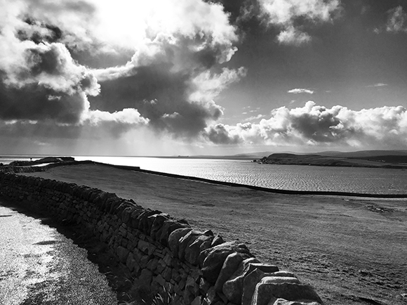
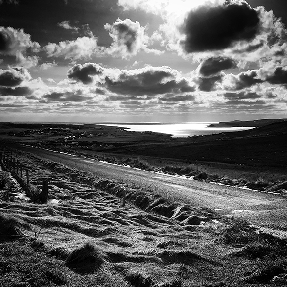
From the minute you arrive on Shetland at Sumbrugh airport - where the runway barely fits on the land - you are constantly aware of the sea. The southern leg of the mainland is only two or three miles wide in places, and as you drive the twenty miles north towards Lerwick, the sea can sometimes be seen to both the east and west. Wind also frequently scours the islands. Locals have spoken to us about the varying characters of the wind that come from each direction - wind from this direction will blow you off your feet, winds from there will be quick, others will sneak under your front door.
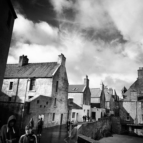
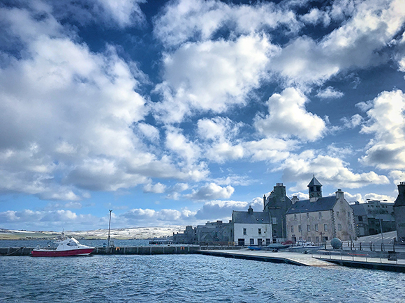
Lerwick was initially established as a seaport to trade fish with the Dutch Fishing Fleet. This original sixteenth century settlement was largely a collection of timber huts that clung to the eastern shore of the relatively sheltered Bressay Sound. In the mid seventeenth century a military outpost was established, Fort Charlotte and around it the first stone buildings constructed.
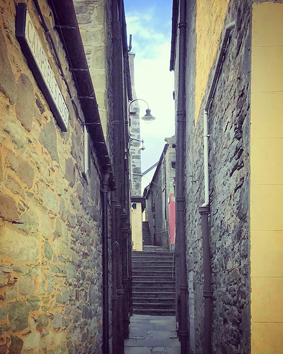
The town developed in a similar way to places such as Stromness in Orkney, and Crovie, Pennan and Banff on the east coast of mainland Scotland. In these settlements simple robust buildings huddle closely together and often present their gables to the sea to mollify the worst of the climate. Doors are tucked out of the direct path of the wind, so when people enter their houses the weather doesn’t follow them in. This arrangement also on occasion gives the places between buildings a sense of drama. Within the intimate, narrow sheltered lanes, vertical glimpsed views are often offered to the immensity of sky and sea. Buildings are also arranged in a slightly haphazard fashion - streets undulate in width and buildings peer past the shoulders of their neighbours. The resulting spaces between, generated by practical responses to the rigours of the climate are rich with character.
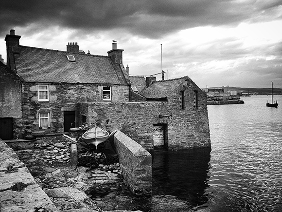
A particular type of building that evolved in Lerwick that literally bridged land and sea were the Lodberrie Houses.“Lodberrie” means flat rock by the shore. These modest buildings comprised a perpendicularly arranged house and store and were built at the shore’s edge, reaching into the water. This allowed boats to be brought close to the buildings and unloaded directly from the sea.
There are important lessons to be learnt here - how simple buildings cluster together to first and foremost give respite from the sea, wind and rain, and in doing so form rich intricate places that in turn create community and identity.
In Georgian and Victorian times Lerwick expanded up the hill behind the old town that gave shelter, away from the sea, and an orderly “new town” was established. The character here is markedly different from the intricate old town. During the 20th century the town has continued to expand westward with suburban housing spreading down towards the Clickimin Loch and beyond.
In the late 1960s rich oil fields were discovered in the North Sea and in 1975 work started on a massive terminal at Sullom Voe in the north of the islands, to receive the crude oil harvested from Brent and Ninian fields. The then newly formed Shetland Island Council was able to ensure that the population of the islands would directly benefit from the flow of oil to the islands. Over the 1980s the Council was able to gain over £100 million every year from the presence of the oil industry and used this money to invest in roads, housing, schools and building a substantial portfolio of sports and community facilities. Today Lerwick is home to over seven thousand people, but around half the population of Shetland either live in or within 10 miles of the town. It is a vibrant and busy place. However recently, much of the traffic and economic activity in the town has moved away from the sea edge towards the western side of the town. Now with the relocation of the Anderson High School - and the many staff and pupils who would wander down Commercial Street into the old town to buy their lunch - the centre of gravity in Lerwick is definitely shifting.
There are also wider economic and social changes taking place in Shetland. The revenue from the oil and gas industry is reducing and so the Council are planning for a very different future and considering how to meet new pressures and circumstances effectively but with less means. The population of Shetland is anticipated to continue to grow but also change in profile as life expectancy increases. This projected shift in the age demographic is being compounded by the aspirations of younger people, many of whom are keen to leave the islands - the lure of further education and employment opportunities on the mainland drawing them away from Shetland.
There is a great and growing need for housing in Shetland but no large scale commercial or speculative developers. Unlike mainland Scotland, the majority of private new houses are self-built. However building one’s own home is something that is beyond most young people. The recent period of relative prosperity in Shetland has exacerbated the housing problem - since 2003 house prices and construction costs have risen dramatically. There are currently plans to build as many as 300 new affordable for rent homes in Lerwick over the next ten years - however this will only address part of the housing demand.
The Council have identified a variety of other specific housing needs that need to be addressed. More homes are needed for older people - who would ideally live independently but might require some help on occasion. The Council are also keen to offer ways for younger people, some returning to the islands from the mainland after further education, to get a foot on the property ladder. Retaining skilled young people will be vital to developing the new potential industries that will fuel Shetland’s changing economy. There is also a need to provide housing for key workers in the health and education sectors - currently it is difficult to attract nurses, doctors and teachers to Shetland and offering suitable affordable housing is seen as vital to maintaining and enhancing existing services.
The Knab site has the potential to address many of these needs, and in doing so, create a place informed by the lessons and patterns of the past that brings new activity, life and commerce back to the old town.
We are excited to be contributing in our small way to this new chapter in the story of Lerwick. We look forward to carrying on the conversations we have started with the local people and to continue to listen and learn more about this place in the north.

